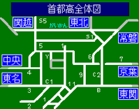
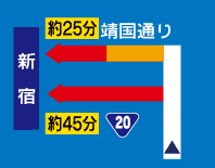
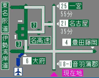
The VICS information is displayed as three types, namely “Maps”, “Simplified graphics”, and “Text”.
Map display (Level 3)
Wide-area VICS information is displayed on road maps of the car navigation.
The traveling point, traffic congestion, and restricted locations can be understood at a single glance.

The detailed information that is provided is as given below.
Traffic congestion information
Heavy congestion is indicated by a red arrow, and light congestion is indicated by an orange arrow.
The length of an arrow represents the distance of the congested road.
Information on parking lots
In addition to the location of parking lots and SA/PA, the parking full or parking available status and guidance to facilities is displayed by colors.

Traffic hindrance information
Accidents, disabled vehicles, obstacles on roads, construction work, and operations, etc. are displayed.

Information on traffic restrictions
Road closures, speed restrictions, and lane restrictions are displayed.

Simplified graphics display (Level 2)
The VICS information is displayed in an easy-to-understand manner through a pattern of simple graphics and text.


From the menu, select the area you want to know about.


Information about direction of advancement can be known based on the car’s position.

The status of parallel public roads can be understood.
There are two types of “Beacon”, one is “Radio wave beacon” that uses radio waves to provide information, and the other is “Infrared beacon” that uses light to provide information.
Text display (Level 1)
The VICS information is output on the display in 30 or less simple characters (15 characters in one row × 2 rows).

Wide-area information of each area is provided.

Information based on the position of the car is provided.
Depending on the car navigation model, there is a difference in the display function of VICS information.
For details, refer to the operation manual of car navigation.